Show MCDOT Your Support for Shared Streets
Early in September, WABA, Action Committee for Transit, Coalition For Smarter Growth, Forest Estates Community Association, Montgomery County Pedestrian Bicycle Traffic Safety Advisory Committee, and Sierra Club in Montgomery County all sent a letter to Montgomery County Department of Transportation Director Chris Conklin. The letter urges MCDOT to designate more low-speed, low-traffic streets for walking and biking on county roads by expanding its Shared Streets program to more neighborhoods.
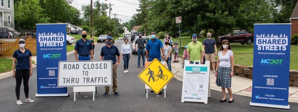
Like Washington, DC and many other major cities, Montgomery County has modified some streets into temporary “neighborhood greenways” which welcome walking and biking while limiting vehicles to local traffic only during the public health emergency. Temporary neighborhood greenways have been created on Grove St in downtown Silver Spring, Holdridge Ave in Glenmont, and Windham Ln in Wheaton to provide more space for physical distancing, outdoor activity and getting around. While not perfect, we believe these are a useful and rapidly implementable tool for improving transportation and recreation options. You can learn more about them and see a map on MCDOT’s Shared Streets website.
Combined with the existing bicycle and trail network and weekend closures of parkways, these temporary neighborhood greenways help safely connect more people with more places. We hope that MCDOT will examine our suggestions closely and implement the proposed Shared Streets segments all over the County to help people get to work, connect to trails, do errands, and stay active.
We propose about 13 miles (map) of county roads as candidates for temporary neighborhood greenways. They are:
- College View Drive from Huggins to Norris (Wheaton – Parallel to Veirs Mill Road) (.7 mi)
- Windham Ln from Georgia Ave to Douglas to McComas Ave to St. Paul Ave (Wheaton to Kensington) (1.2 mi)
- Grandview Ave from Blue Ridge to Randolph (Wheaton to Glenmont) (1.0 mi)
- Woodland Drive from Spring Street to Highland Drive, to Crosby to Sligo Creek Trail (Silver Spring to Montgomery Hills) (1.1 mi)
- Ellsworth Drive from Cedar to Bennington to Sligo Creek Trail (DTSS to Sligo Creek) (.9 mi)
- Osage Street from Carroll Avenue to Tahona Drive to 12th Avenue to New
- Hampshire Avenue (Takoma Park) (.5 mi)
- Sudbury Road from Plymouth Street to E. Franklin Ave (Long Branch) (.6 mi) and Domer Avenue from Flower Ave to Barron Street (.3 mi)
- West Virginia Avenue from Lynbrook Drive to Wisconsin Avenue (East Bethesda) (.4 mi) and Pearl Street/Maryland Avenue from Sleaford to Jones Bridge (.7 mi) and Cheltenham Drive from Maryland Ave to Wisconsin Ave (.3 mi)
- Brandermill Drive from Middlebrook Road to Oxbridge Drive (Germantown) (.8 mi)
- Spartan Road from MD-97 to Old Baltimore Road (Olney) (1.2 mi)
- Amherst Ave from Dennis Avenue to Arcola Avenue (Wheaton) (1.4 mi)
- Lewis Avenue from Halpine Road to First St. (Rockville Pike) (1.3 mi)
- Kara Lane from E Randolph Road to Autumn Drive, Autumn Drive from Kara Lane to Eldrid Drive, Eldrid Drive from Autumn Drive to New Hampshire Avenue (Colesville) (1.0 mi)
If you like our proposals and want to see more Shared Streets across the county, email MCDOT.SharedStreets@montgomerycountymd.gov, Director Conklin (christopher.conklin@montgomerycountymd.gov) and the County Council (County.Council@MontgomeryCountyMD.gov) to show your support.
You can read the full letter here.
You must be logged in to post a comment.