
Happy Friday,
In case you missed the news, we’ve postponed the 50 States Ride by a week. It was a tough call—we’ve never had to postpone a Signature Ride before, but the combination of high winds and heavy rain are going to make a group ride unsafe. So if you’re already signed up, or if you’re not, I hope we’ll see you next weekend.
There’s some good news too!
- The DC Council passed a bill that will provide substantial rebates on ebike purchases. In addition to being fun and convenient, ebikes are a great way to reduce car-dependence and get more folks riding.
- The Montgomery County Council passed a Safe Streets Act, which has several excellent policy changes to improve safety, especially for folks outside of cars.
- Our pals at Girls in Gear are kicking off their fall season this weekend.
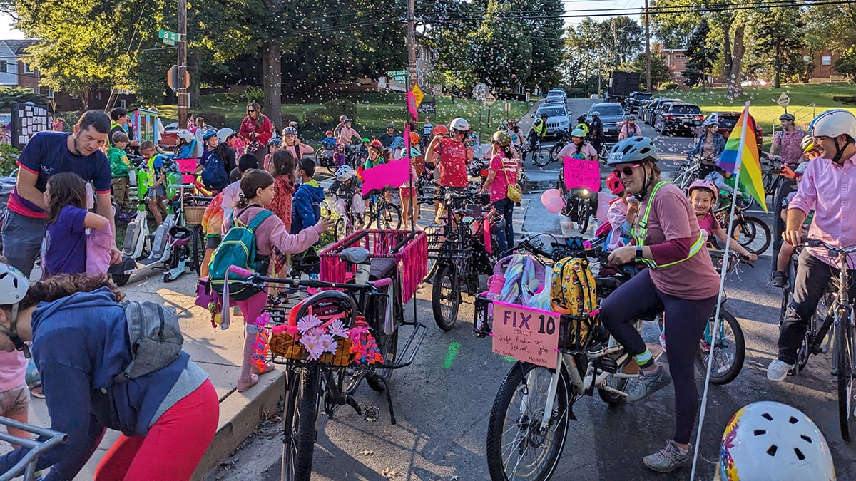
- A group of parents at Mundo Verde’s Calle Ocho campus have started a bike bus on Fridays. Last week, they had more than 100 riders. Can’t imagine a better way to get to school. (https://waba.org/wp-content/uploads/2023/09/MV-Bike-Bus.jpg)
Things to do this week:
- There are a bunch of public meetings coming up that need folks to speak up for better biking. Have a look at them all here.
- Join the “I Bike, I Buy Stuff” Campaign: Business owners are an important stakeholder for street safety redesigns. Join our campaign to remind business owners on Connecticut Ave that their customers get there by bike.
- Support Better Bike Connections at the Brookland Metro: A new development proposed for the Brookland Metro Station offers an opportunity for better bike connections. Read more from Ward 5 For All and take action!
- Support 24/7 Bus Lanes on Florida Ave: Florida Avenue is one of the most important streets in NE and NW DC and it should have 24/7 bus lanes.
- Take the King Street-Bradlee Safety & Mobility Enhancements Survey: Alexandria is looking for input to improve safety and access on King Street between N. Quaker Lane and Menokin Drive.
- Take the Mount Vernon Trail Visitor Use Survey: Another opportunity to shape the Mount Vernon Trail! Share your experiences via a new visitor use survey today.
- Take the Georgetown Transportation Access and Circulation Study Survey.
- Chime in for better biking around development at Poplar Point on the Anacostia River Trail
A Fun Route-Planning Idea For the Weekend
Look, riding in a possible tropical storm is probably not a good plan, so let’s work on some adjacent skills instead. If you’re not already an expert at route planning, make a cup of tea, pull up RidewithGPS (not a sponsor, we just like them), and make your own route. They’ve got a great Route Planning 101 tutorial. Here are my 102-level tips for making a fun route:
- Roads that look wiggly on the map are usually more fun that roads that are straight.
- Google Streetview (available inside the RidewithGPS route planner) is a great way to scope out whether a road will be fun (or at least safe) to ride on. Look for shoulder width, how many cars are visible, speed limit signs, and what condition the pavement is in.
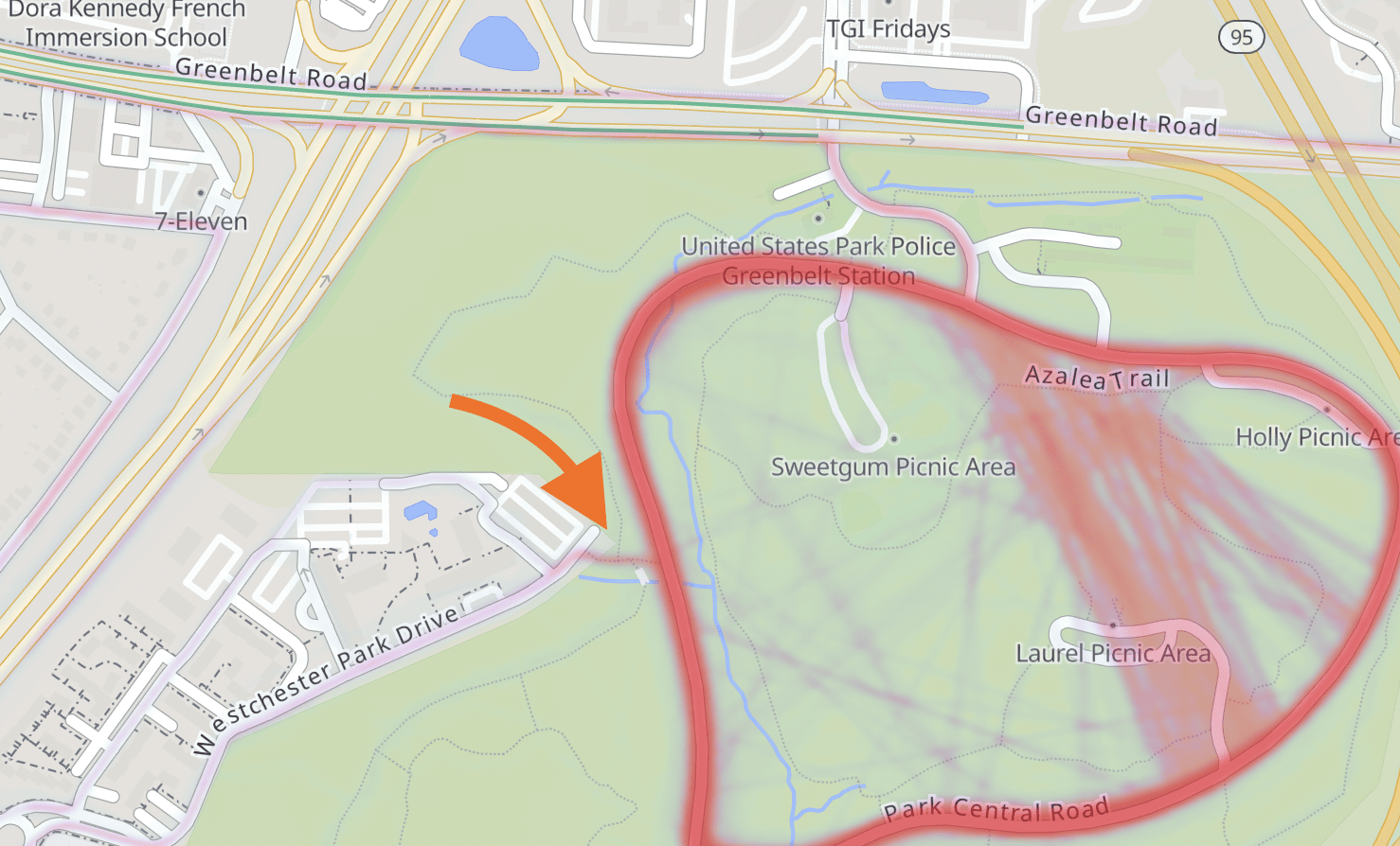
- Heatmaps are great. RidewithGPS has one, but it’s part of their premium plan. Strava’s is free in a limited form. If you’re already familiar with an area, the heavy lines on a heatmap will probably be pretty obvious. But I find the format very useful for answering the question “is this connection on the map real?” For example, I like riding in Greenbelt Park, but I really don’t like riding on Greenbelt Road (a strong contender for the Maryland State Highway Administration’s most terrifying and useless bike lane). There’s an apartment complex next to the park and it seems like there’s probably a way to access the park roads from that complex. Sure enough, the heatmap says it’s possible:
- For unpaved trails, it can sometimes be a challenge to answer the question: “am I allowed to ride my bike here?” Montgomery County’s online atlas makes it easy—clicking on a trail will show a bunch of information, including allowed uses. For other jurisdictions, I often find myself googling for PDF park maps, like this one from the Patuxent River Park which usually have clear rules for where you’re allowed to bike.
Start from home, or pick a metro station and plan a route you’ve never ridden before. When the weather’s better, go ride it and report back. Got your own route-planning hacks or tips? Let me know!